To view on Facebook, click HERE
This last weekend we decided to hike up broken top, starting at Todd Lake. The first few miles are nice and easy - not too much elevation gain, and nice scenery. The "hardest" part is crossing some of the streams without getting wet!
One we got to the Broken Top trail (3.5 miles in), the shade was essentially gone, but the wildflowers were starting to bloom! Some of the hike was really pretty, but to be honest parts were very bare and boring (no real views, flowers). There weren't many people on the trail to begin with, but everyone we saw turned around before getting to what I considered the destination...I started wondering if it was even worth going up further.
Right when I started thinking that, we came across a relatively small, but powerful, waterfall!
Wanting to know its source, we climbed up the side of the waterfall (a bit harder than it looks) and found this beautiful lake/pool (It's bigger than the photo makes it look. For an idea of its size - this is 6 photos stitched together)!
This alone would have made the hike worthwhile. The water, reflection, and rock colors are just stunning, but just a short (very steep) hike up the side revealed a gorgeous view of the 3 Sisters Mountains! Maybe I'm strange, but I just can't get enough of those mountains.
Thursday, July 25, 2013
Saturday, July 20, 2013
Balloons Over Bend 2013
View on facebook HERE and HERE
It's that time of year again - time to get out of bed earlier than you have to, and make your way down to Riverbend Park and watch the hot air balloon launch!
Friday night I made my way down to Farewell Bend Park and set up across from the Night Glow location. I know it might seem weird to go to a different park, but I was really trying to capture the reflections of the beautiful balloons on the river.
Friday, Saturday, and Sunday morning around 6:30AM is when the balloons actually launch. I would recommend getting there a little early to watch the setup! Although I absolutely loved helping with the setup, chase-crew, and actually taking a balloon ride last year, it was really nice to just sit back and admire their beauty over Bend (from a distance).
Tomorrow is your last chance to see this in Bend until next year, so set your alarm a little early, make some coffee, and head on down to Riverbend Park. You won't regret it!
Sunday, July 7, 2013
Sunset Over Crater Lake - Mt Scott
With an extended weekend, it seemed like the perfect time to visit Crater Lake! Less than 2 hours South of Bend, Crater Lake seemed like the perfect place to spend a little time to enjoy nature (more on that in a later post).
We did a little research before driving out, and found out that Mt. Scott is the highest point in the park, and has a great view of Crater Lake. That sounded like the perfect place to be at sunset!
I called Crater Lake ahead of time and was told the trail was closed due to snow still being on the trail...that is a lie. There were 2 very tiny mounds of snow that you could easily either walk around, or take a step over (by the time you read this, they'll probably be gone). The hike is 2.5 miles each way and rated as strenuous (personally, I don't think it deserves that difficulty rating).
We got up there about 35 minutes before sunset, and had the place to ourselves! It was so peaceful watching the setting sun without any distraction.
The sky was still a beautiful orange color as we made our way down the hiking path, only really getting dark as we got in the car. Perfect timing!
Interested in buying a print? Click HERE
Monday, July 1, 2013
South Sister Summit Hike
View on Facebook HERE
Some people said it was too early in the year to hike South Sister, that there was too much snow to make it safely to the top. Well, I have one thing to say to those people: You're wrong!
Early Sunday morning we left Bend and drove to the Devil's Lake Trailhead. From there, it was 6.25 miles to the summit of South Sister (Oregon's 3rd highest peak). Was there snow? Heck yes. There was a lot of snow, but given the choice of snow or the cinder and scree that lies beneath, I would choose snow every time!
The view of Middle and North Sister with a little snow cover really can't be beat! It's a tough hike towards the top (right around Lewis Glacier), but just put one foot in front of the other and keep going - it's worth it!
Lewis Glacier Melt Pot/pool, near the top of South Sister. It's bigger than it looks!
For any hikers out there who want to hike to South Sister's summit in late June or early July: we didn't really need any special gear. Hiking boots and gaiters would be nice, but they're not necessary (we hiked with running shoes, nothing else). We brought crampons just in case, but they weren't needed. The last mile or so is the toughest and steepest, but at that point we were hiking on/fighting with red cinder and scree.
Monday, June 24, 2013
Tam McArthur Rim Trail
View on Facebook HERE
This weekend we took advantage of the only nice day (Saturday), and hiked up the Tam McArthur Rim trail. We saw reports of snow on the trail, so I wasn't really sure how difficult the hike was going to be. As you drive up to Three Creeks Lake, you see the rim, almost majestic over the water, with mountains in the background. Yes there was snow, but it didn't look too intimidating! The first mile or so on the trail is bare and in perfect condition. There are some down trees that block the path in a few areas, but nothing you can't easily climb over or go around.
The last mile and a half is a bit trickier. The snow starts out minimal, but soon the trail is completely covered and you're essentially on your own to figure out which way to go. The trick is this: Although the trail is lost, the goal is to get up to the top area of the rim. As long as you follow around the rim, you should get to your destination.
The best viewing point on the rim! Broken top and the Three Sisters Mountains.
We hiked up a bit further to see if the view got getter, or to see if Broken Top was more visible, but this ended up being the best! It might not look like much, but the mountains look so close and huge, and the cliff/slope with the snow on it is really breathtaking! To the right is also two lakes (Three Creeks Lake and Little Three Creeks Lake). Beauty really surrounds you, and personally I think the snow adds to that!
If you're feeling adventurous, this hike is very do-able right now, or wait for the snow to melt. Both will end with amazing panoramic views!
Monday, June 17, 2013
Painted Hills - John Day Fossil Beds National Monument
Less than 2 hours out of Bend is the Painted Hills unit of the John Day Fossil Beds National Monument (1 of 3 units). I had seen pictures of this seemingly beautiful place, but hadn't visited myself until this weekend. When you arrive, you see different beautiful shades of red, orange, gold, and even some black mixed in. The hills really do look painted - how else would they look like that? ;)
Really though, the unique colors and patterns were formed by volcanic eruptions and climate change over the past 35 million years. There are signs everywhere explaining in more detail, but honestly it's a little hard for me to grasp the whole story.
At painted hills there are multiple viewpoints, trails (about 2.75 miles total), and picnic areas. One of the most important things they stress is to stay off the exposed hills, because it takes a long time for the area to repair itself.
The colors of the hills change a lot with with time of day and moisture (I've heard the colors are very rich after some rain), but it's a stunning sight, no matter when you visit!
Thursday, June 13, 2013
Clear Lake and Great Springs
*Water colors are not enhanced*
About 30 minutes West of Sisters, Oregon, is Clear Lake. Like the name suggests, the water in Clear Lake holds some very clear BLUE water! The water is very cold (around 36˚-43˚), which makes it hard for algae to thrive there. Because of that, you can see the 3,000 year old trees submerged in the lake, essentially preserved by the nearly freezing water.
On the North side of the lake is Great Springs. To get there, you can either walk along the hiking path that goes around the lake (4.6 mile loop), or rent a rowboat and paddle your way over. As you get closer to the spring, the water gets bluer and bluer. Finally you get to the little cove, and it appears that the water is flowing out of nowhere. In reality, the fresh spring water is coming from under the rocks! If you come out to Clear Lake, PLEASE go see Great Springs. You won't regret it! The beautiful blue color of the water compliments the green scenery that surrounds it in Late Spring, and the butterflies near the water are icing on the cake!
If you're looking to Spend the day out here, you can hike, boat (no motors), fish, or camp around the lake. Santiam Fish and Game regularly stocks the lake with trout, so if that's your thing - bring your fishing pole, rent a rowboat for the day ($30), and try your luck. Even if you don't catch anything, it's so beautiful you might not even care!
Monday, June 10, 2013
Mount Bachelor Hike
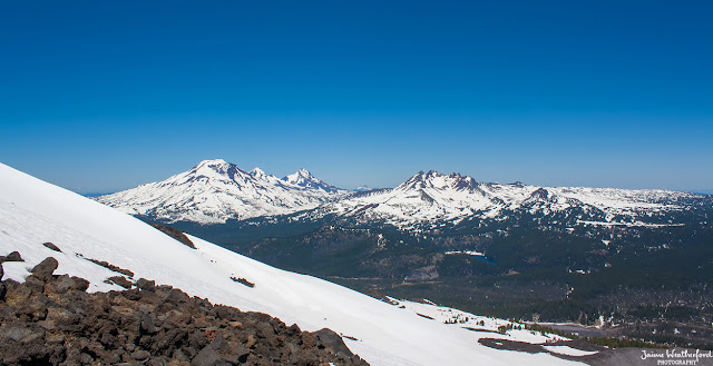
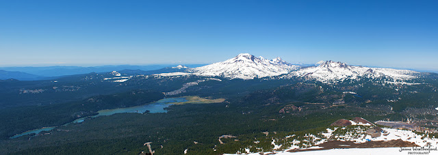
Do you live in Central Oregon and ski/snowboard? If so, you've probably been to Mt Bachelor. Maybe you have even taken the Summit lift to the top and enjoyed the view. I, however, do not ski or snowboard, and had never had the pleasure of enjoying the panorama from this Central Oregon treasure. On Sunday that changed. Ski season is over, so it seemed like the perfect time to hike to the top of Mount Bachelor! We stopped in to Pine Mountain Sports and rented a set of snow trekking poles (only $5 for the whole day!), since the mountain is still covered in snow, and headed up to the mountain. From the parking area, Mt Bachelor does not seem intimidating - but the 2.5 mile hike, and 2500 foot elevation gain was not exactly what I would call easy!
I can see why people love this mountain, and am a bit jealous of those who call Bachelor home on the weekends during ski season.
Above - near the top of Bachelor. Beautiful view, but it gets better!(see how steep the hike is??)
Taken from Mt Bachelor's "true summit". Although the mountains look small/far away, that's just because of the panoramic viewpoint. In reality they are HUGE and look so close!
*If snow hiking is not your thing, the snow will eventually melt. According to Mt Bachelor's website, you can buy a chairlift ticket (adult $17/seniors $14) starting July 4th, which will take you about half way up. From there you can either hike to the top, play disk golf, eat a meal at Pine Marten Lodge, or just enjoy the beautiful views!
View on Facebook HERE
Friday, June 7, 2013
Tamolitch Pool
This is part 3 (and the final part) of my McKenzie River Trail posts!
First I want to say this: The blue in the photos is completely untouched/un-enhanced. This is how the water photographed, and it's even more beautiful in person.
The Tamolitch Pool (also known as the Blue Pool) is the main reason I wanted to hike along the McKenzie River. I had seen pictures of it before, and had to see if it was really that beautiful for myself. After you hike past the waterfalls, you come to a dam, and after that the river seems to dry up. The trail has dried up river beds with fallen trees, no water, and in my opinion, is a pretty ugly part of the trail. After a couple miles though, you suddenly come to this stunning blue pool where the McKenzie River starts again. The river didn't really dry up, it just went underground, and when it reappears, it is pure and COLD! The water looks inviting and refreshing, but it sits around 40˚, which makes it hard to enjoy a leisurely swim. Although the Blue Pool looks shallow, it's up to 40 feet deep, and a popular place for people to cliff jump in the Summer. We ended up doing what we called an "offroad hike" and climbed down to the water. It's a bit of a hidden path if you don't know where to go, but with good shoes is very manageable for most fitness levels.
Pictures do not do this justice! If you are in the area, pack up some lunch, make the hike, and enjoy this beautiful hidden gem. You won't regret it!
Tuesday, June 4, 2013
Koosah Falls
View on Facebook HERE
This is part 2 of my McKenzie River Trail posts. Along the same waterfall trail (a shorter trail on the 26 mile McKenzie River Trail) is Koosah Falls. The 70 foot falls might be a little smaller than the nearby Sahalie Falls, but it is no less beautiful, or powerful! It took less than 15 minutes to see both falls, so if you come to see one, I think it's worth it to take a little extra time to see both. You won't regret it!
PS - Yes, the water is that blue!
Monday, June 3, 2013
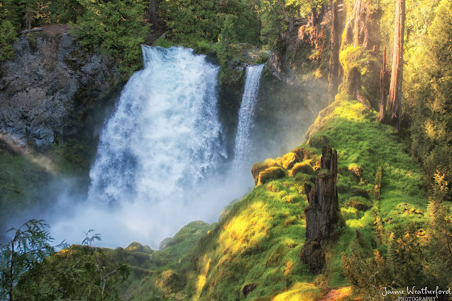
Sahalie Falls
Photo taken from the Sahalie Falls Viewpoint:
On the first leg of the hike, we walked down the opposite side of the river, and I was able to grab a little different perspective. The color of the water was incredible:
Tuesday, May 21, 2013
Paulina Peak - Newberry Caldera
Although the Paulina Peak trail is still closed, the ranger said we could still hike if we wanted to. Warning of steep areas covered in snow, she said we would be one of the first this year to hike to the top! Sparing you all the details, I'll just say she was right - it was an extremely challenging trail, but the reward we got was worth it! Paulina Lake had a mesmerizing shade of blue, almost looking tropical. Don't let the photo fool you, though. That water is cold! When the snow melts and the trail officially opens, I'm definitely planning on going up again.
For any non-hikers, you can see this view for yourself, too! The viewpoint is accessible by car, and you can drive right to the top. However, you'll have to wait for the road to open, because right now that is covered in snow and closed for the season.
For any non-hikers, you can see this view for yourself, too! The viewpoint is accessible by car, and you can drive right to the top. However, you'll have to wait for the road to open, because right now that is covered in snow and closed for the season.
Monday, May 20, 2013
Newberry Crater - Little Crater
Yesterday I headed out to Newberry Crater for a hike, only to be told that the trail I wanted to use was still covered in snow and "closed". The ranger recommended Little Crater - not nearly as long of a hike, and not as much of a climb, but snow free. The Little Crater Loop is just shy of 2 miles long, and perfect for families. While on the loop, you can sneak a peek at East Lake, and get a very pretty view of Paulina Lake (the Twin Crater lakes).
The view was pretty, but we wanted more! To be continued...
(hint - the Photo/view tomorrow comes from the top of the peak on the left)
View on Facebook HERE
The view was pretty, but we wanted more! To be continued...
(hint - the Photo/view tomorrow comes from the top of the peak on the left)
View on Facebook HERE
Thursday, May 16, 2013
Tam-a-láu Trail - Cove Palisades State Park
Tam-a-láu trail is a hike that I had never heard of before. Near Culver, Tam-a-láu trail is located in Cove Palisades State Park. A fairly easy-moderate 1 mile hike (gaining 600 ft) gets you to the top of the canyon, with beautiful views of the rivers/lakes, mountains, and the beauty that surrounds the area. Once you get to the top, there is a 4 mile flat loop that you can choose to do. If you have the time, I recommend it!
Wednesday, May 15, 2013
Smith Rock - Misery Ridge
I've done 3 hikes so far this year, and so far the shortest hike (up), has been the hardest. Misery Ridge at Smith Rock is a 3/4 mile hike (from the bottom of the trail to the top of Smith Rock), and although short, was fairly tough on this out of shape girl. Saying that, the views are spectacular! Pictures really do not do it justice. From the top, you can decide whether you want to go down the same way you went up, or take a much longer route down and around - we chose the latter (down the Mesa Verde trail, and along the river trail ~ 3 miles).
Tuesday, May 14, 2013
View from Black Butte
Now that Spring/Summer weather is starting to show its face in Central Oregon, it's time for me to go explore! Last weekend I hiked up Black Butte. If you're in the area and never been, I recommend it! It's a bit tough at places, but bring plenty of water (and a camera), and take breaks if needed. You won't regret it, the views are amazing! Here is one of the wonderful views from about midway up Black Butte:
View on facebook HERE
Tuesday, February 12, 2013
Bill Healy Memorial Bridge
I'll be the first to admit that sometimes I'm distracted pretty easily. While at Farewell Bend Park, I began to cross under the Bill Healy bridge, and saw the water reflecting a beautiful color of green. The river itself is not green, but between the sun shining, and the water reflecting up to the bridge and back down, it looked like a colorful rainbow of red, yellow, green, orange, and blue under the busy bridge that connects Century Drive and the Old Mill District!
Can be view on facebook by clicking HERE
Can be view on facebook by clicking HERE
Monday, February 11, 2013
Ollie the Owl and his Friend
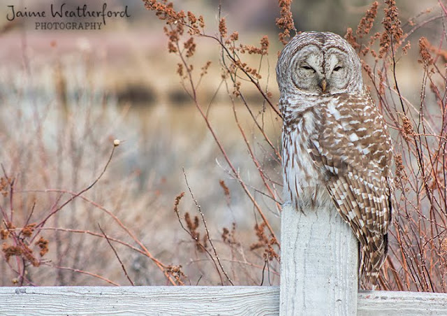
I made my way to Farewell Bend Park again today. Ollie the Barred Owl was out, and very social. I first saw him up in a tree behind the fence along the path, but within 5 minutes he had made his way down to the fence post to say "hello"!
While Ollie was getting so much attention from everyone passing by, a cute little blue bird made his way down to the fence making as much noise as possible. I decided he deserved some attention, too!
Sunday, February 10, 2013
Looking down the Deschutes
First things first! I finally started a facebook page ( Click Here ) Yay! I'm still going to post here the same amount, but the facebook page should help me reach more people.
The beautiful light at sunset never ceases to amaze me...it's pure natural beauty. Whether you're downtown, in the Old Mill, or admiring from the comfort of your home, it's just stunning if you take a second out of your busy day to admire it (easier said than done sometimes).
The beautiful light at sunset never ceases to amaze me...it's pure natural beauty. Whether you're downtown, in the Old Mill, or admiring from the comfort of your home, it's just stunning if you take a second out of your busy day to admire it (easier said than done sometimes).
Saturday, February 9, 2013
Calm Water Near Benham Falls
Just 10 minutes outside of Bend is Benham Falls, and a nice trail with some beautiful scenery surrounding it. The trail I walked was an easy 1.3 mile path, and at the end was calm water with a stunning blue sky reflecting in it. Central Oregon sure has a way of doing nature right, don't you think?
If you don't feel like walking the trail for whatever reason, you can park your car farther away from Benham Falls (in the picnic area) and just enjoy this area by itself.
For me, it's amazing to see Benham Falls transform from wild rapids to peaceful waters in such a short distance. When I think about it, it's pretty symbolic of life.
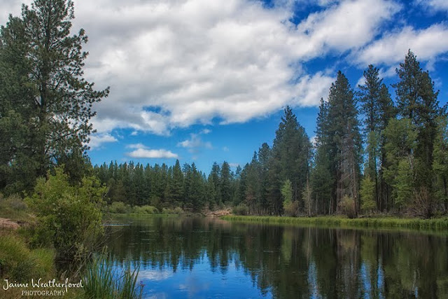
*June 2012
If you don't feel like walking the trail for whatever reason, you can park your car farther away from Benham Falls (in the picnic area) and just enjoy this area by itself.
For me, it's amazing to see Benham Falls transform from wild rapids to peaceful waters in such a short distance. When I think about it, it's pretty symbolic of life.

*June 2012
Thursday, February 7, 2013
Barred Owl in Bend
*If you are interested in purchasing a print, click HERE
I decided to go to Farewell Bend Park for a nice relaxing walk, and look who I found waiting for me! "Ollie" the Barred owl has been in the news lately, but I really didn't expect him to be so unaffected by cameras or people! He stayed on the fence for a good 30 minutes before flying to a nearby tree.
I decided to go to Farewell Bend Park for a nice relaxing walk, and look who I found waiting for me! "Ollie" the Barred owl has been in the news lately, but I really didn't expect him to be so unaffected by cameras or people! He stayed on the fence for a good 30 minutes before flying to a nearby tree.
*For more photos click here
Saturday, February 2, 2013
Sunset from Awbrey Butte
Another beautiful sunset today in Bend, I hope they keep coming! With Spring right around the corner (thanks for the heads-up, Punxsutawney Phil!), my guess is that the colors will just keep getting better!
Friday, February 1, 2013
Sunset Over River's Edge Golf Course
Tonight's sunset was another stunner. The sky lit up with beautiful tones of blue, pink, orange, and yellow.
Sights like this are unbeatable. How can you *not* be happy after experiencing this every evening? Just another reason to love Bend, Oregon.
Thursday, January 31, 2013
Birds Eye View of Pilot Butte
If you live in Bend then it's very likely that you've seen Pilot Butte, and probably made a trip to the top for a nice view of the mountains surrounding Bend. Today I want to post a perspective of Pilot Butte that I don't think is seen very often - a view from above Pilot Butte looking down. Look closely and you can see all the early morning people who came to say hello!
*Photo taken from a hot air balloon.
*Photo taken from a hot air balloon.
Tuesday, January 29, 2013
Winter Sunset
I've been in a funk lately. I'm not sure if it's the time of year, weather, or what. Now that I think about it, it probably is the weather; I want either sunshine or snow (preferably sunshine), not this in-between stuff! However, nothing can brighten my mood faster than a pretty sunset.
Friday, January 25, 2013
A Taste of Maui
Aloha!
Ok, really, hello from Bend. I know this is assumed to be a photo blog about Oregon (by the URL), but I have photos I want to share from other places in the world. So here is a photo I took during my 15-day vacation to Maui this last October. The sunrises and sunsets in Maui were always beautiful. Like in Bend, they are always sure to please!
Happy Friday, and I hope everyone has a wonderful weekend!
Happy Friday, and I hope everyone has a wonderful weekend!
Tuesday, January 22, 2013
Jupiter
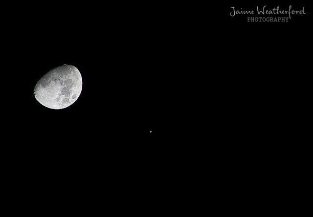
Did you hear that last night the moon and Jupiter appeared *super* close? Sadly, I was a little late hearing this news and didn't step outside to see for myself until late in the night, so they didn't appear as close anymore. I saw/heard conflicting reports. Some said that Jupiter wouldn't appear that close to the moon again until 2026, but NBC said that they'll be another "close pairing" like this March 17th of this year. Either way, it's still fun to go outside and enjoy & observe things that are many times ignored.
(That tiny little dot? That's Jupiter!)
(That tiny little dot? That's Jupiter!)
Tuesday, January 15, 2013
Juniper
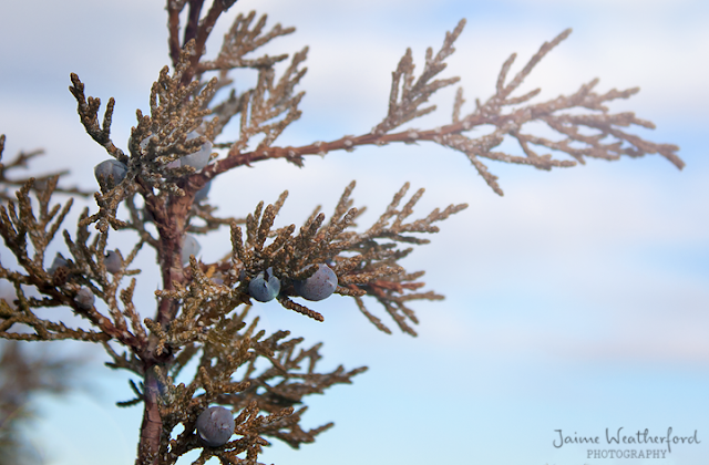
Sometimes it's hard for me to appreciate the little things that surround me. The warming weather (even if it is still cold), the peacefulness of our neighborhood, and the abundant presence of Juniper trees that surround Central Oregon. Some people love these trees, others hate them; for once I took a moment to just appreciate their beauty.
Monday, January 14, 2013
Simple Beauty in Bend
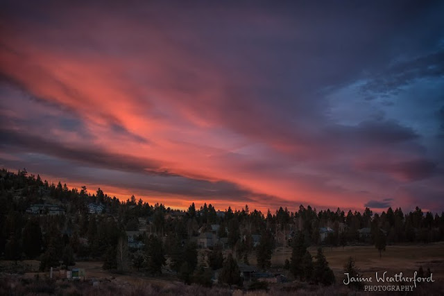
I'm sure everyone knows by now how I am a huge fan of Bend sunsets. I'm sure sunrises are nice too, if I ever woke up in time for those. I just cannot get enough of the natural, simple beauty that surrounds this wonderful city!
Saturday, January 5, 2013
Unknown Couple
I'm not usually one to photograph people (not my comfort zone), but sometimes they fit into whatever I am trying to photograph very well. This is not a recent picture, but I was combing over my external hard drive and opened this up. This was taken in the Old Mill, sometime in September 2011. I really wish I knew who this couple was. The sunset was beautiful, and they seemed to be just enjoying each other and nature. Is it the best photo, probably not; but it's a very honest, candid moment that they might appreciate. Bend has so many visitors that come and go, but if anyone knows this couple let me know. Maybe they'd like a copy of this picture (full size, unmarked copy).
I know it's a long shot, and very unlikely (especially with it being a shot without faces)...but there's more of a chance than if I don't post/ask at all.
Wednesday, January 2, 2013
Winter Wonderland
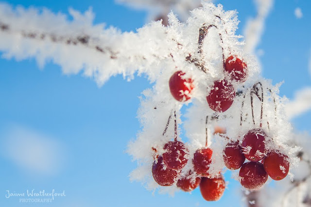
This morning we had freezing fog, which cleared up fairly quickly. What it left was beautiful frost on everything!
I decided to go for a walk around the neighborhood, and although it was cut short (it's 10˚ right now!), I managed to get this photo. I love how even with blue skies and the sun shining, Bend looks like a Winter wonderland!
Tuesday, January 1, 2013
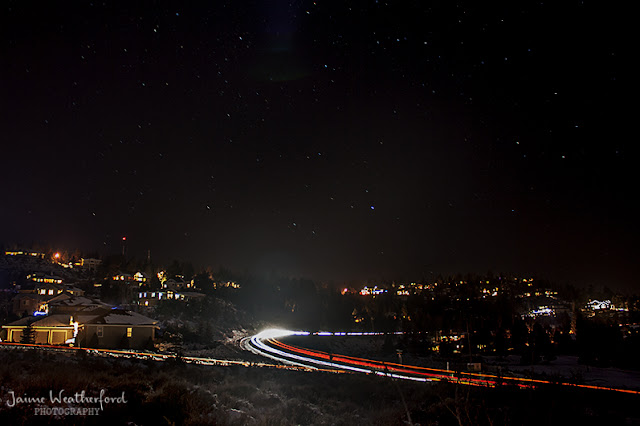
Beautiful Clear Night
It's a beautiful, clear night tonight in Bend. The moon is bright, the stars are shining, I couldn't think of a better way to start off the new year.
Subscribe to:
Posts (Atom)


